
Kilimanjaro facts at a glance
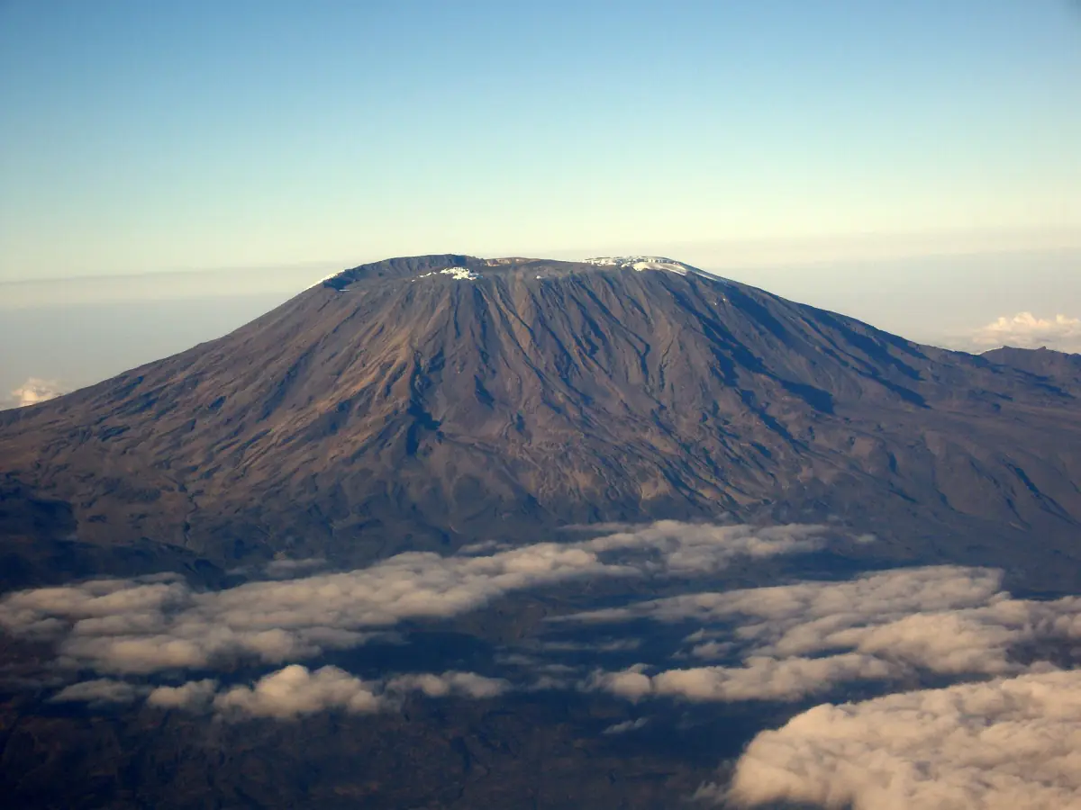
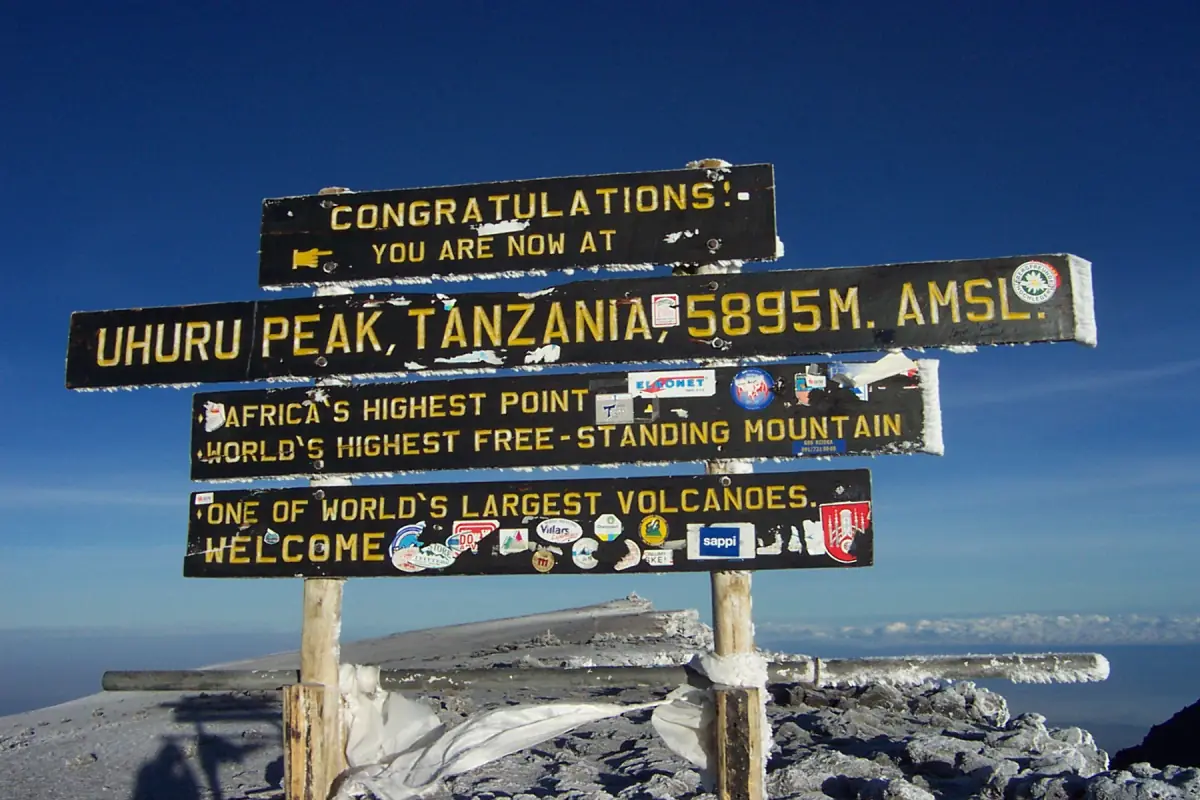
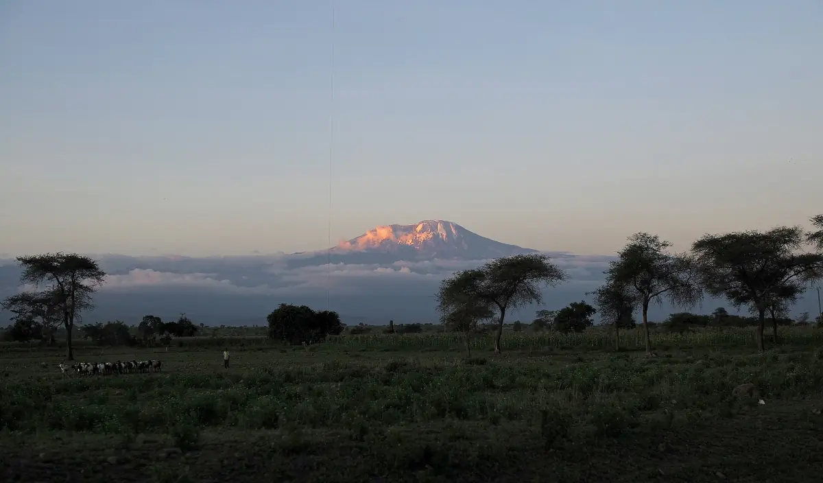
Kilimanjaro is a volcanic massif in northern Tanzania. Its highest point, Uhuru Peak on the Kibo cone, stands at 5,895 m and is the highest point in Africa. The mountain lies inside Kilimanjaro National Park, which has been a UNESCO World Heritage Site since 1987.
Most facts about the mountain are simple to state. What takes more care is how they fit together: three cones are not the same as five zones, and the park and the World Heritage area have different sizes. This page keeps the numbers apart so you can use them for planning. If you are ready to look at trips, start with our overview of Kilimanjaro tours.
Key figures
The numbers most readers look for, in one place.
| Subject | Figure | Good to know |
|---|---|---|
| Kibo (Uhuru Peak) | 5,895 m | The summit most climbers aim for |
| Mawenzi | 5,149 m | The second-highest cone |
| Shira | 3,962 m | The lowest cone, with the Shira plateau |
| Vegetation zones | 5 | Lower slopes, montane forest, heath and moorland, alpine desert, summit zone |
| World Heritage area | 75,575 ha | The listed area, not the whole national park |
| National park area | 1,712 km² | The extended park, including the forest belt added in 2005 |
| Glacier area lost | About 91 percent | Since the first mapping in 1912, by area and not by volume |
| Park established | 1973 | Opened to tourism in 1977 |
For most readers, the two figures that shape a trip are the summit height of 5,895 m and the rule that climbs need a licensed operator and guide. Everything else is background.
Our pick: all the way round Kibo
Our take: the Northern Circuit circles the mountain over eight days.
Hand-picked tours, booked through GetYourGuide. Prices are indicative starting prices in US dollars (as of October 2026). Tap a tour for live availability and the current price in your currency.
Kilimanjaro climbs and day trips
Treks on the main routes, day hikes and safari combinations, with live prices and availability.
Three volcanic cones
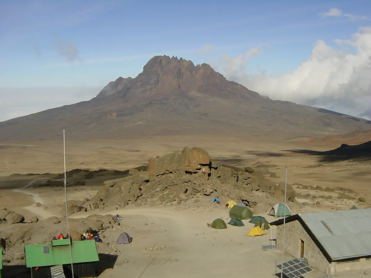
The massif is made of three volcanic cones. Kibo is the tallest at 5,895 m and holds the summit crater and Uhuru Peak. Mawenzi reaches 5,149 m and is a peak in its own right. Shira, at 3,962 m, is the lowest of the three. The Lemosho route crosses the Shira plateau, and the Shira route starts high on the Shira Ridge.
The origin of the name Kilimanjaro is not known with certainty. If you read a single neat translation, treat it with caution.
On the Marangu route you can look across to Mawenzi from the Kibo hut. Knowing the three cones helps you read the mountain once you are on it.
Five zones from forest to summit
The zones are a way to describe the changing landscape, not fixed height bands.
Lower slopes
The farmland and villages at the foot of the mountain. Coffee is grown on the slopes around Moshi.
Montane forest
Forest trails with streams, waterfalls and stone steps. The forest belt was added to the national park in September 2005.
Heath and moorland
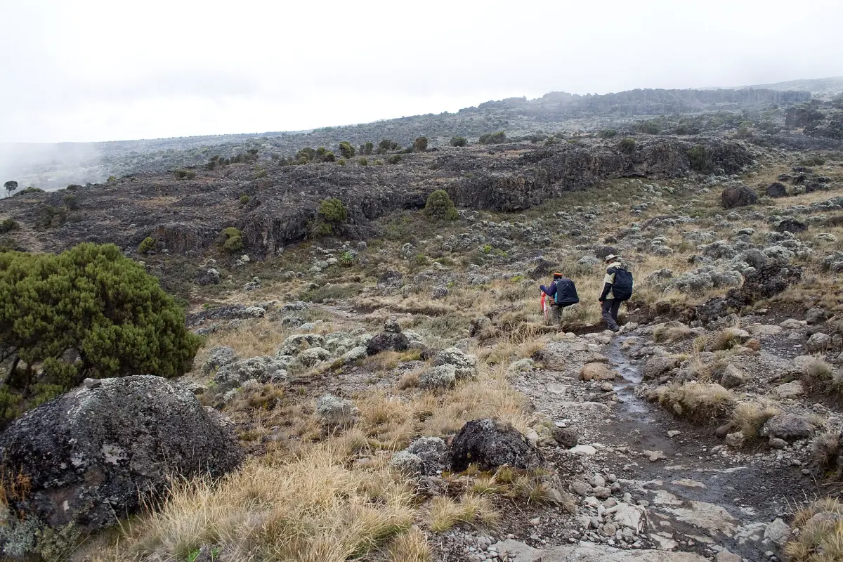
Open ground with giant groundsels. The trees give way to lower plants and the views widen.
Alpine desert
Bare, open slopes high on the mountain with little plant life.
Summit zone
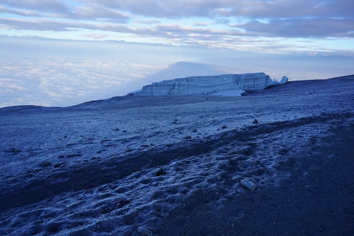
The glaciers near the summit and Uhuru Peak, where it is cold and the air is thin.
The height at which one zone gives way to the next is not the same everywhere, so do not rely on a single table of metres. On the Machame route, for example, the camps lie at about 2,850 m (Machame Camp), 3,810 m (Shira 2), 3,976 m (Barranco) and 4,673 m (Barafu), which takes you through several zones in a few days.
Glaciers and the summit ice
The glaciers near the summit have lost about 91 percent of their area since the first mapping in 1912. The figure dates from January 2025. It refers to area, not volume, and the ice keeps changing.
Snow cover on the upper mountain varies, so plan for cold, wet and windy weather rather than for a set amount of snow. Our page on Kilimanjaro weather explains how conditions change with height.
Park, rules and wildlife
What the protected area means for a visit.
Licensed guides only
You climb with a licensed operator and guide. Solo trekking is not allowed.
Climbing Kilimanjaro →Gates and routes
Climbs start at Marangu, Machame, Lemosho via Londorossi, or Rongai in the north. Mweka is used for the descent.
Routes compared →Park rules
Stay on marked paths, follow camp rules and ranger instructions, and ask for permission before you fly a drone. Open fires are restricted.
Wildlife
The protected area is home to elephants, buffalo and antelope. Sightings are not guaranteed.
For classic wildlife viewing, many visitors combine the climb with a safari, for example in the Serengeti. Our Kilimanjaro and safari page shows how that works.
Kilimanjaro facts: frequently asked questions
How high is Kilimanjaro?
The highest point is Uhuru Peak on the Kibo cone at 5,895 m. Mawenzi reaches 5,149 m and Shira 3,962 m.
Is Kilimanjaro one volcano?
It is a volcanic massif with three cones: Kibo, Mawenzi and Shira. Kibo is the highest, and its summit is the goal of most climbs.
How many climate zones does Kilimanjaro have?
There are five main zones: lower slopes, montane forest, heath and moorland, alpine desert and the summit zone. The heights where they begin differ from place to place.
Will the glaciers still be there when I visit?
Ice is still present near the summit, but the glaciers have lost about 91 percent of their area since 1912. The amount of snow on the day varies, so pack for cold and wet conditions.
Can I climb Kilimanjaro without a guide?
No. Climbs need a licensed operator and guide, and solo trekking is not allowed.
Is kilimanjaro-national-park.org the official park website?
No. This is an independent travel guide with no connection to the national park authority, the park or any climbing operator.